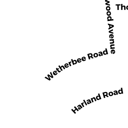
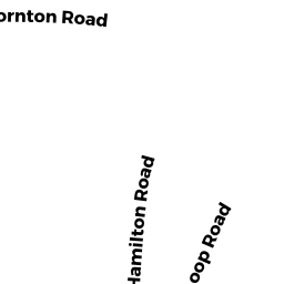
84 THORNTON RD
Owner Information
MALKIN FAM IRREV TR; DANIEL
84 THORNTON RD.
WALTHAM, MA 02453-7647


Property Details
84 THORNTON RD is classified as a Single Family Residential (Colonial).
The primary structure on this property was built in 1932. There are 1924ft2 of built area within this property. There is 1924ft2 of residential/living space within this property. This property is listed as having 7 rooms.
84 THORNTON RD is valued at 636100. The land is valued at 316800 and the structures are valued at 314200. There is an additional valuation of 5100 on this property.
The most recent deed for 84 THORNTON RD is recorded at the local registrar in Book 72753, Page 549. 84 THORNTON RD was last sold on 2019-06-13 for 10.
Assessment data from fiscal year 2022.
Flood Data
According to the FEMA National Flood Hazard Layer, this property does not appear to be in a flood zone. It may also be in an area not yet reviewed. Nonetheless, confirm this information prior to taking any action.
To view the flood hazards around this property, create a FEMA "Firmette" Map of the area around 84 THORNTON RD.
Broadband Internet Providers
| Provider | Type | Bandwidth (mbps) | |
|---|---|---|---|
| Comcast | Cable | 1000 | 35 |
| Verizon New England Inc. | Fiber | 940 | 880 |
| Viasat Inc | Satellite | 100 | 3 |
| VSAT Systems, LLC. | Satellite | 2 | 1 |
| HughesNet | Satellite | 25 | 3 |
| GCI Communication Corp. | Satellite | 0 | 0 |
| RCN | Cable | 500 | 20 |
Broadband service provider data from December 2020.
Adjacent Properties
- 75 CEDARWOOD AVE
Single Family Residential owned by McNEMAR, DONALD W.,& BRITTA S. - 78 THORNTON RD
Single Family Residential owned by DEVINE, GREGORY D. & LYNELLE - 88 THORNTON RD
Single Family Residential owned by KOPETSKI, GEORGE & SHARLENE A. - 65 WETHERBEE RD
Single Family Residential owned by TIBERIO, JOSEPH J. & - 59 WETHERBEE RD
Single Family Residential owned by EAGLE, ROBERT J.